
City History
Late 1700s - Early 1800s
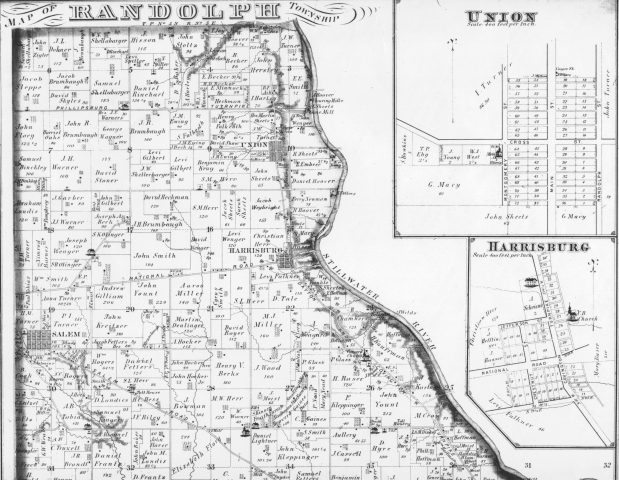
Settlers from the eastern and southern United States discovered a corner of the Miami Valley nestled near the Stillwater River. The region formed first as Elizabeth Township but soon was renamed to Randolph Township.
1806-1816
The community of Union was founded and then platted in 1816 by Daniel Razor and David Hoover. At the time, Englewood was known as Harrisburg and Clayton was known as Salem.
1800s Commerce
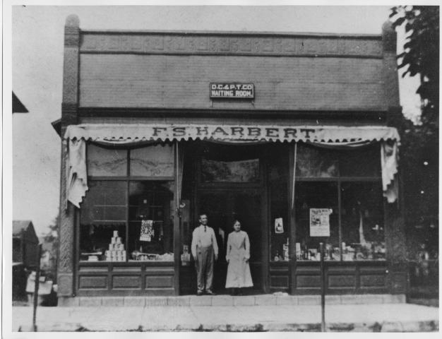
Settlers quickly developed the area into an agricultural community, with a "downtown" of shops along what is now North Main Street. F. S. Harbert was a variety store along North Main Street (this photo is believed to be taken in the late 1800s or early 1900s). Barrels, guns, tile, pottery, brick and carriages were some of our earliest products. And although sometimes disputed, the turbine wheel was first made and tested in Union.
1800s Living
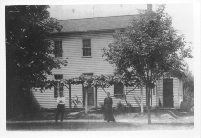
A frame house on North Main Street. The identities of the people and when the photo was taken are not known.
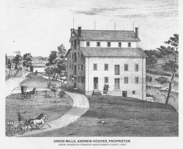
1800s Mills
Union became the location of many mills, including the Hoover grist mill, Shaw sawmill and Sheets boring mill, the latter of which manufactured long rifles. Pictured here is a mill that was owned by prominent Union citizen Andrew Hoover. The mill was powered by the Stillwater River.
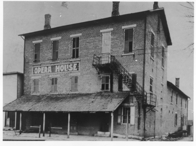
1800s Opera House
Union grew to have all of the amenities of a larger town, including an opera house and post office. Union's Opera House, which featured actual operas, provided entertainment for early residents. The building, which stood on Main Street, burned years ago.
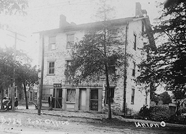
1800s Post Office
This photo is believed to be the first U.S. Post Office in Union. It was located on the northwest corner of Main Street and Martindale Road.
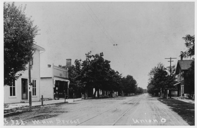
1800s - 1900s Transportation
The Dayton-Covington-Piqua Toll Road running through Union was constructed in the mid-1800s and served as a primary route through western Ohio. The interurban rail line, the C.H. & D. (Cincinnati, Hamilton and Dayton), stopped at the Union Depot (today what is 214-216 W. Martindale Road). After the line ceased operation in August 1922, the building was moved to the south side of the street and converted to a residence. The building still exists at 209 W. Martindale Road. The rail line tracks are visible in this photo looking north on Main Street.
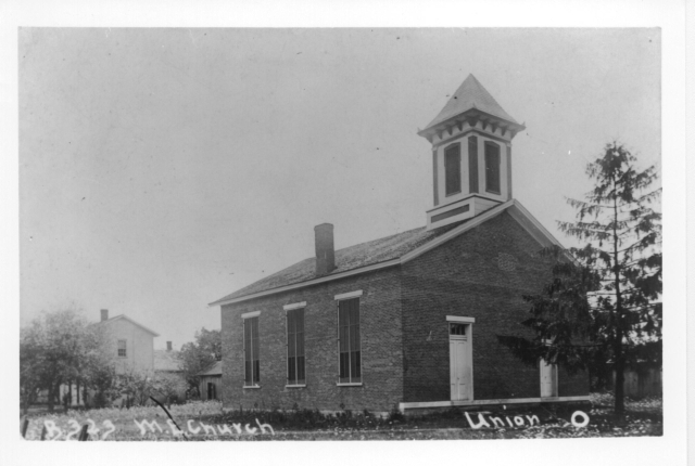
1800s - 1900s Faith
The Union Methodist Church was organized in 1855 with about 75 members. A meeting house soon was built with a name and date stone on the gable end inscribed “Union Free Church.” A storm damaged the building in 1912 and the stone was removed during repairs, leaving a round brick patch on the gable above the two doors. The church eventually was relocated on what today is the southwest corner of West Martindale Road and Montgomery Street in Union. The addition of colored-glass windows in 1940 and a west wing in 1961 have changed the look of the church. This building was sold when the United Methodists moved into their new church on Shaw and Phillipsburg-Union Roads.
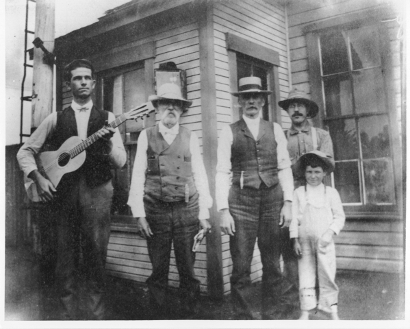
1800s Entertainment
Union citizens worked hard and worshipped faithfully. They also took time to enjoy festivals and community gatherings Perhaps this photo is a scene from Union's first festival? Pictured from left: Albert Embree, George Eby, David Younce, Dode Eby, Paul Eby.
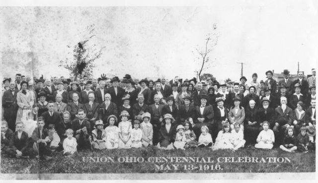
1916 Centennial
Union's centennial celebration was held on May 13, 1916, and attended by many of the townspeople, merchants and area farmers.
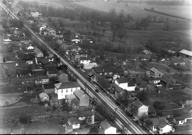
1926 Aerial Photo
Aerial photos of Union were taken by William Mayfield who also captured aerial photos of 46 local towns and cities in conjunction with department store Rike-Kumler's 73rd anniversary celebration.
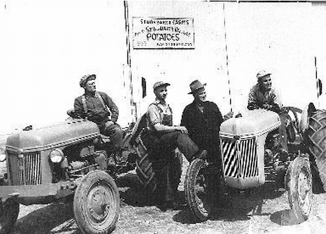
1900s Farm Life
Farms surrounding Union were plentiful. Pictured here are workers from the Studebaker potato farm on the Dayton-Covington Pike (today known as Route 48). Another well-known farm, the Levi and Sarah Gilbert Homestead, was located on Sweet Potato Ridge Road between Old Mill and Rinehart roads. The farm was sold to Joseph and Margaret Hunkler circa 1925. In 1940, the farm was sold to the Rupert family. In later years, the house and barn fell into disrepair and were destroyed; the site eventually became Mill Ridge Village, a retirement community operated by the Church of Brethren.
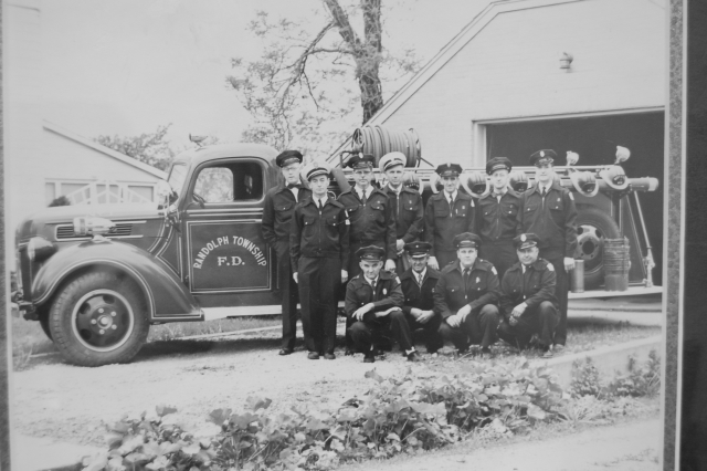
1900s Public Safety
Union's Public Safety Department first started as an all-volunteer Fire Department operated by Randolph Township, with stations eventually in the three incorporated cities of Union, Englewood and Clayton. Union formed its own Fire & Rescue Department in the late 1990s. The Public Safety Department today also includes the City's Police Department.
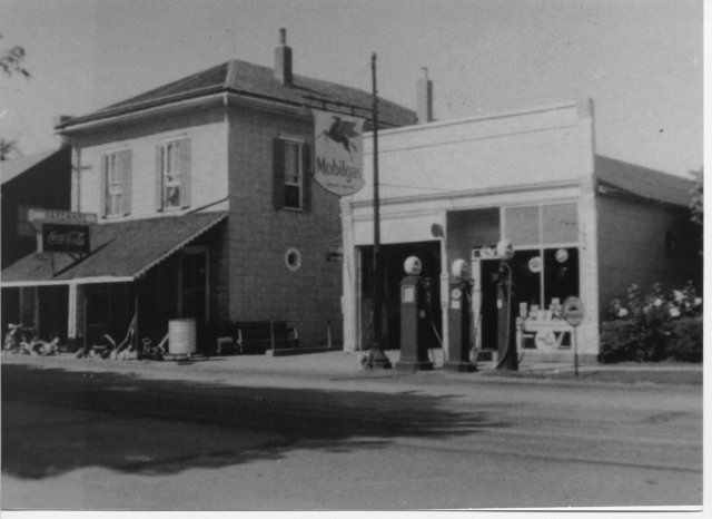
1900s Main Street
More people were owning and driving cars--a gas station opened on Main Street. Right next to it: the location that would later become Hine's Hardware.
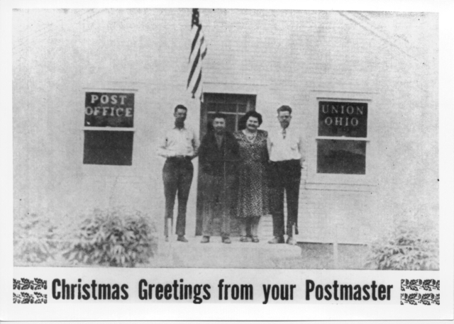
1900s Post Office
Union's Post Office, originally on Main Street, was relocated to West Martindale Road sometime in the mid-1900s where it operated for many years before postal operations in the township were consolidated to a location in Clayton. Pictured from right: Dale Bidwell, Post-Mistress Jean Brown and Berlin Scherer. The identity of the man on the left is not known.
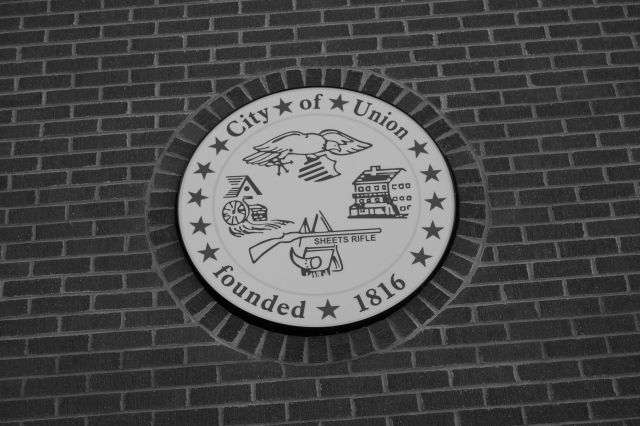
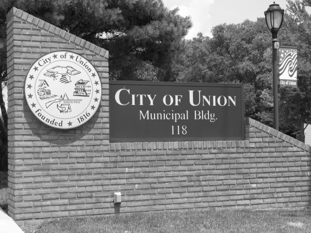
1986 City Seal
Union's City seal was dedicated Nov. 10, 1986, at a City Council meeting. The seal, also a flag, was designed by Union resident Melissa Ann Post. The center of the flag depicts some of Union's history by representing two of the City's landmarks of the 1800s--the Razor Mill and the Union Opera House. The flag also depicts one of the City's earliest local industrial products, the Sheets Rifle. The American Eagle, in the center of the flag, represents our City's nationalism. The two rings encircling the center are symbols of the City Charter and the State Constitution. Inside the two rings are 13 stars representing Union as the 13th city to be added to Montgomery County. The border encompassing the entire flag symbolizes the U.S. Constitution.
1982 - present
Union continues to grow and prosper well into the 20th century, adding more people, more businesses and more homes--becoming an official city in 1982. Today's population is 6,859 (2020 census).. Our boundaries stretch 8.770 square-miles, from just east of Dog Leg Road across from Dayton International Airport, to Sweet Potato Ridge Road to the south, to Haber Road to the west and to Frederick-Garland Road to the north. We've come a long way since the early days--our first settlers probably wouldn't recognize our city with its many beautiful new homes, companies and commercial enterprises, parks and green-belt areas, not to mention paved streets versus the 1800s' dirt roads! But some things never change. Like community spirit and pride. Commitment to a place we call "home." Helping one's neighbor. And the joy of watching families blossom. We have all of these intangible qualities in Union. If you would like to learn more about our region's history, or if you have information or photos to share, be sure to contact the Randolph Township Historical Society, of which Union is a founding member. This organization was formed in 1998 to help preserve the rich heritage of Randolph Township and today's cities of Union, Englewood and Clayton.Contact the Randolph Township Historical Society, Inc. at 114 Valleyview Drive, Englewood, Ohio, 45322, or visit them on the Web.